Mayumiotero – Remote Sensing has transformed the way people observe and understand the planet. Instead of relying solely on field surveys, governments, researchers, and businesses now use satellite imagery and advanced sensors to collect accurate data from thousands of kilometers above Earth. As technology continues to evolve, Remote Sensing has become one of the most valuable tools for environmental monitoring, agriculture, disaster management, and urban planning. Moreover, artificial intelligence has made satellite image analysis faster and more precise. Consequently, organizations can respond to environmental changes more efficiently than ever before. This technology not only supports scientific research but also helps decision-makers create smarter and more sustainable policies for the future.
Read Also: Anthropic Launches Claude Sonnet 5, Its Most Agentic AI Model Yet
What Is Remote Sensing and Why Does It Matter?
Remote Sensing is the science of obtaining information about objects or areas without making direct physical contact. In most cases, satellites, aircraft, or drones equipped with specialized sensors capture data from Earth’s surface. These sensors detect reflected or emitted electromagnetic energy, which is later processed into useful images and maps. Unlike traditional observation methods, Remote Sensing covers vast areas in a relatively short time. Therefore, it has become essential for monitoring forests, oceans, cities, and agricultural land. As climate and environmental challenges continue to grow, the ability to collect reliable information remotely offers tremendous advantages for governments, scientists, and industries seeking accurate, real-time insights.
How Remote Sensing Works Behind the Scenes
Although the process appears complex, the basic concept is straightforward. First, energy from the Sun—or from active sensors such as radar—is directed toward Earth’s surface. Different materials reflect this energy differently depending on their physical characteristics. Next, sensors mounted on satellites or aircraft record these reflections. Afterward, advanced software converts the raw information into digital images that experts can analyze. Finally, specialists interpret the results to identify environmental changes, vegetation health, water quality, or urban expansion. Thanks to improvements in computing power and cloud-based processing, Remote Sensing now delivers faster and more accurate analyses than it did only a decade ago.
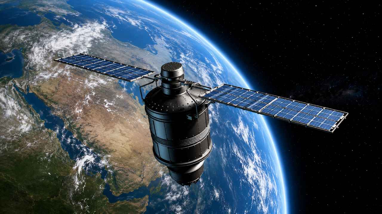
Satellite Imaging Expands Earth’s Global Monitoring Network
Satellite imaging represents one of the most important applications of Remote Sensing. Modern satellites continuously orbit the planet while capturing high-resolution images of land, oceans, and the atmosphere. Some satellites revisit the same location every few days, allowing experts to compare changes over time. As a result, governments can monitor deforestation, track glacier melting, and observe urban development with remarkable precision. Furthermore, commercial satellite operators now provide imagery with sub-meter resolution, making it possible to identify roads, buildings, and even individual vehicles. This growing network of satellites has significantly improved global environmental monitoring and emergency response capabilities.
Remote Sensing Supports Agriculture and Food Security
Agriculture has become one of the largest beneficiaries of Remote Sensing technology. Farmers and agricultural organizations rely on satellite data to monitor crop growth, estimate yields, and detect drought stress before visible damage occurs. In addition, multispectral imagery helps identify nutrient deficiencies and irrigation needs more efficiently than traditional inspections. Consequently, farmers can apply fertilizers and water only where necessary, reducing costs while improving productivity. Precision agriculture powered by Remote Sensing also supports sustainable farming practices by minimizing waste and protecting natural resources. As global food demand continues to increase, these technologies will play an increasingly important role in ensuring long-term food security.
Read Also: Minimal Luxury Design Creates Elegant Spaces with Timeless Sophistication
Disaster Management Benefits from Faster Data Collection
Natural disasters often develop rapidly, leaving little time for preparation. Fortunately, Remote Sensing provides emergency responders with critical information before, during, and after disasters occur. Satellite imagery helps identify flood zones, wildfire locations, volcanic eruptions, landslides, and earthquake damage within hours. Additionally, radar satellites can operate through clouds and darkness, making them especially valuable during severe weather events. Emergency agencies use this information to coordinate evacuations, assess infrastructure damage, and distribute aid more effectively. Because accurate data arrives quickly, response teams can prioritize resources where they are needed most, ultimately helping save lives and reduce economic losses.
Artificial Intelligence Makes Remote Sensing Even Smarter
The combination of Remote Sensing and artificial intelligence has dramatically expanded the technology’s capabilities. Machine learning algorithms can automatically recognize buildings, roads, forests, water bodies, and agricultural fields from millions of satellite images. Instead of relying solely on manual interpretation, analysts now receive automated insights within minutes. Furthermore, AI models continuously improve as they process more data, increasing accuracy over time. This advancement allows governments and businesses to detect environmental changes almost in real time. As computing technology becomes more powerful, AI-driven Remote Sensing will continue delivering faster predictions and supporting more informed decision-making across multiple industries.
The Future of Remote Sensing Looks More Connected Than Ever
Remote Sensing continues to evolve alongside advances in satellite technology, drones, cloud computing, and artificial intelligence. Future satellite constellations will provide even more frequent observations with higher image quality and lower operational costs. Meanwhile, drones equipped with advanced sensors will complement satellite data by capturing detailed local information whenever necessary. Experts also expect stronger integration with Geographic Information Systems (GIS), Internet of Things (IoT) devices, and predictive analytics. Together, these technologies will create a comprehensive monitoring ecosystem capable of supporting smarter cities, sustainable agriculture, environmental conservation, and disaster resilience. Ultimately, Remote Sensing is becoming an indispensable technology for understanding and protecting our rapidly changing planet.