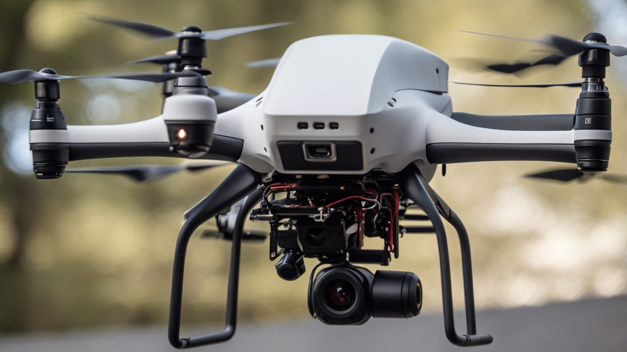
Mayumiotero – Visual-Inertial Odometry is transforming how drones understand their surroundings and maintain stable movement across complex environments. Because GPS signals often fail in indoor spaces, forests, or urban canyons, drones need an alternative method to track their position. As a result, VIO has emerged as a crucial solution that blends camera vision with inertial measurements. From my perspective, this technology feels like giving drones a new level of “awareness,” allowing them to fly more intelligently and safely.
“Read also: How Meta’s WorldGen Is Transforming the Future of Interactive 3D Worlds“
How Visual-Inertial Odometry Works at Its Core
At its foundation, Visual-Inertial Odometry combines two major data streams: visual information from onboard cameras and motion data from an IMU. When these two sources are fused through real-time algorithms, the drone can estimate its position with impressive accuracy. Additionally, VIO constantly updates its calculations to account for changes in orientation, speed, and acceleration. I find this synergy fascinating because humans rely on similar cues sight and body balance when navigating unfamiliar spaces.
The Dual-Sensor Fusion That Makes VIO So Precise
The strength of VIO lies in sensor fusion, meaning the system leverages the advantages of each sensor while covering their weaknesses. Cameras provide rich environmental detail but struggle in low-light or fast-motion scenarios. Meanwhile, the IMU offers precise acceleration and rotation data but drifts over time. By merging these two, VIO delivers highly stable navigation. In my opinion, this balance mirrors teamwork, where one sensor compensates when the other falters.
Why Drones Benefit More from VIO Than GPS Alone
Many drone missions depend on accuracy beyond what GPS can offer. For example, indoor inspection, warehouse automation, and search-and-rescue operations require centimeter-level precision. Because VIO does not rely on satellites, it performs consistently even when GPS is blocked or jammed. Moreover, the lightweight nature of camera and IMU modules makes VIO ideal for compact drones. As I see it, VIO empowers drones to navigate like autonomous explorers, not just GPS followers.
Real-World Applications of VIO in Advanced Drone Systems
Visual-Inertial Odometry is already embedded in drones used for industrial mapping, filmmaking, and environmental monitoring. For instance, FPV drones depend heavily on VIO to maintain stability during extreme maneuvers. Additionally, autonomous delivery prototypes use VIO to navigate narrow alleys and indoor corridors. What impresses me most is how VIO enables drones to complete tasks previously considered impossible without human pilots.
“Read more: ChatGPT Group Chats: A New Way Teams Connect“
Challenges That Engineers Face When Implementing VIO
Despite its strengths, VIO still presents several technical challenges that developers must overcome. Poor lighting, motion blur, reflective surfaces, and vibration can interrupt visual tracking. Furthermore, sensor calibration must be precise; otherwise, the positional estimates may drift. Even with these limitations, continuous improvements in AI-based feature extraction are making VIO more robust. In my view, the ongoing research shows how dynamic and innovative the field remains.
The Role of AI and Machine Learning in Evolving VIO
Artificial Intelligence elevates Visual-Inertial Odometry by improving visual feature detection, noise reduction, and motion prediction. Because machine learning models learn patterns from thousands of flight scenarios, they can predict how drones should react in uncertain conditions. Additionally, deep-learning-based SLAM systems enhance mapping capabilities far beyond classical algorithms. This integration of AI, to me, marks the beginning of a new era where drones become more adaptive and autonomous.
How VIO Will Shape Next-Generation Drone Navigation
As drone technology continues to evolve, Visual-Inertial Odometry will become even more central to navigation systems. Soon, compact drones may use multi-camera VIO, event-based sensors, and AI-enhanced IMUs for unmatched precision. Furthermore, cloud-assisted VIO could enable drones to share environmental data collectively, much like a digital hive mind. Personally, I believe this future will redefine how drones collaborate, communicate, and operate in the real world.